

The Big Dawg Weather Blog is presented by:
- A-Plus Comfort Care
- Central Ky Construction & Concrete
- Razed Right Barbershop
- Insulation Solutions of Ky
.PNG)
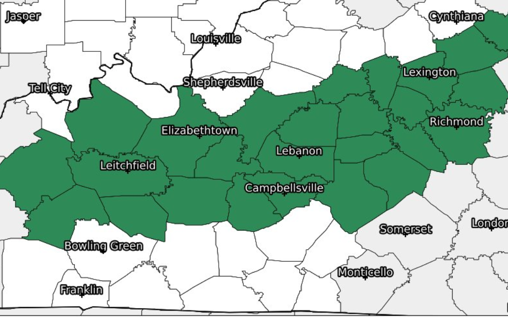
HIGH WINDS
Very gusty winds and the potential for strong to severe thunderstorms will arrive Wednesday afternoon into Wednesday evening ahead of a strong cold front. Wind gusts Wednesday afternoon will be
45-55 mph ahead of the evening showers and storms. There is also an enhanced fire danger for locations east of I-65 tomorrow afternoon. Strong winds, dry fuels, and low relative humidity will make for challenging conditions to control any outdoor burning.
45-55 mph ahead of the evening showers and storms. There is also an enhanced fire danger for locations east of I-65 tomorrow afternoon. Strong winds, dry fuels, and low relative humidity will make for challenging conditions to control any outdoor burning.
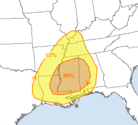
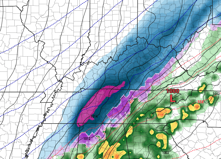
SEVERE WEATHER THREAT
Showers and embedded thunderstorms will potentially have locally enhanced wind gusts and a brief spin-up tornado Wednesday evening. Storms are expected to be in the central Kentucky area between 8-11 PM EST. The SPC has placed the entire area in aq SLIGHT risk for severe weather, which means scattered severe storms are possible. This could get upgraded based on how tomorrow plays out. I will be monitoring things closely, and I will provide LIVE severe weather coverage if severe storms break out.
SPC OUTLOOK
.PNG)
.PNG)

.PNG)

.PNG)
.PNG)
.PNG)

.PNG)
.PNG)
.PNG)
.PNG)

.PNG)
.PNG)
.PNG)
.PNG)
.PNG)
.PNG)


.PNG)

.png)