

A-Plus Comfort Care presents the Big Dawg Weather Blog! For experienced care for your heat & air, give them a call at (270) 932-7421
Good Monday night, everyone! I continue to track a very powerful storm system that will begin to impact our region Tomorrow night as rain, with a wintry mess possible Thursday afternoon into Thursday night.
Here is the approximate timeframe that we are looking at, and this timeline will become more evident during the day tomorrow and Wednesday.
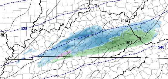
Tuesday Night through Wednesday Night: Rain moves into the region, with temperatures rising into the 50's. Rainfall amounts of 2.75 to 3.5 inches are expected across the region with isolated higher amounts.
This amount of rainfall is expected to create excessive runoff, resulting in localized flooding in some areas.
Thursday: Arctic Front will slowly progress across the state from Northwest to Southeast, with temperatures dropping roughly 20-25 degrees. Rain will change over to Freezing Rain/Sleet throughout the day. As of this post, central Kentucky would likely change over to freezing rain during the afternoon/evening hours on Thursday.
Thursday Night through early Friday morning: All precipitation changes to Freezing Rain, sleet, and some snow.
Tonight's data has some agreement to it, but some questions still need to be answered. The biggest question is how fast will this arctic air move in. If it's slower, we will be looking at more rain and less freezing rain. If the arctic air is faster, we'll be looking at more freezing rain across central Kentucky. This will not be a heavy snowmaker for our area. The heavy snow is expected to stay well to the north.
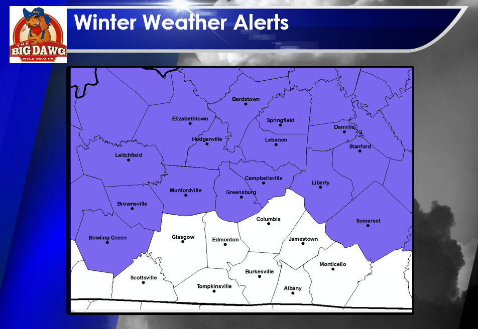
NOTICE: Now is the time to pay attention. Nothing is set in stone, but central Kentucky is being threatened by what could be a very significant Ice storm, and this doesn't need to be taken lightly. I will be tracking this storm every step of the way.
Here is the latest model data for tonight. The only piece I haven't seen is the EURO, and it will update in a few hours.
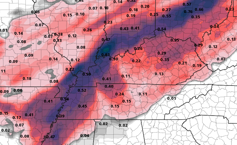
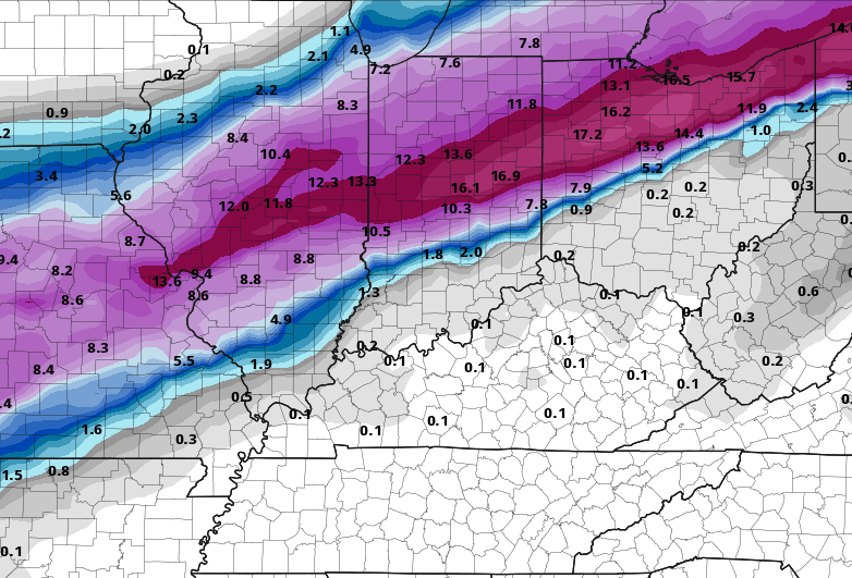
NAM Potential Ice Accumulation:
.PNG)
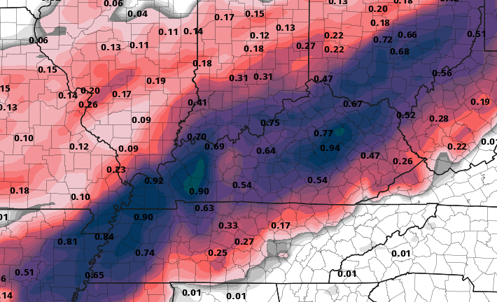
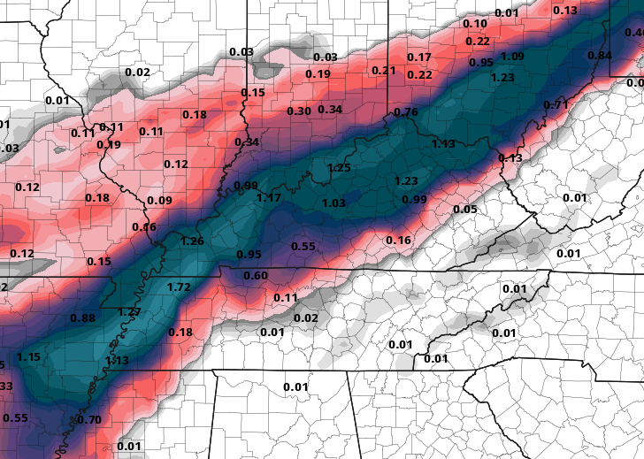
RDPS Potential Ice Accumulation:
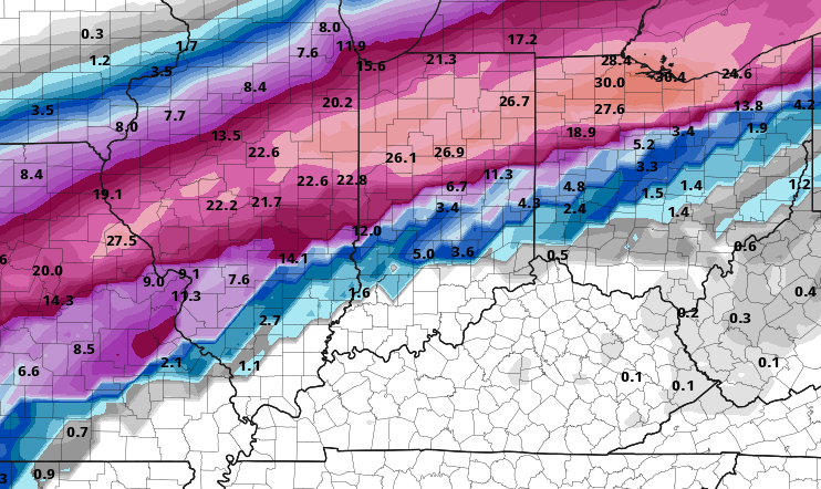
GFS Potential Ice Accumulation:
.PNG)
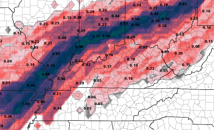
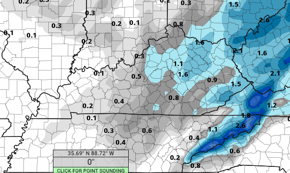
GDPS Potential Ice Accumulation:
The next 24 hours will be vital in figuring out how this system plays out, so pay attention to the latest forecasts and prepare for this potential Ice Storm!
Be sure you are following me!
Facebook: Corey Lynn Houk
Twitter: 2khoukwx


.png)