


The Big Dawg Weather Blog is presented by:
- A-Plus Comfort Care
- Central Ky Construction & Concrete
- Razed Right Barbershop
- Insulation Solutions of Ky
.PNG)
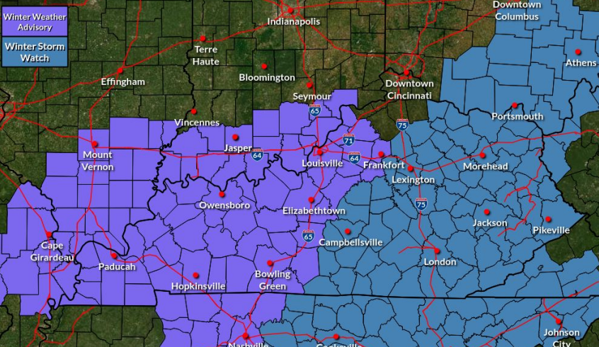
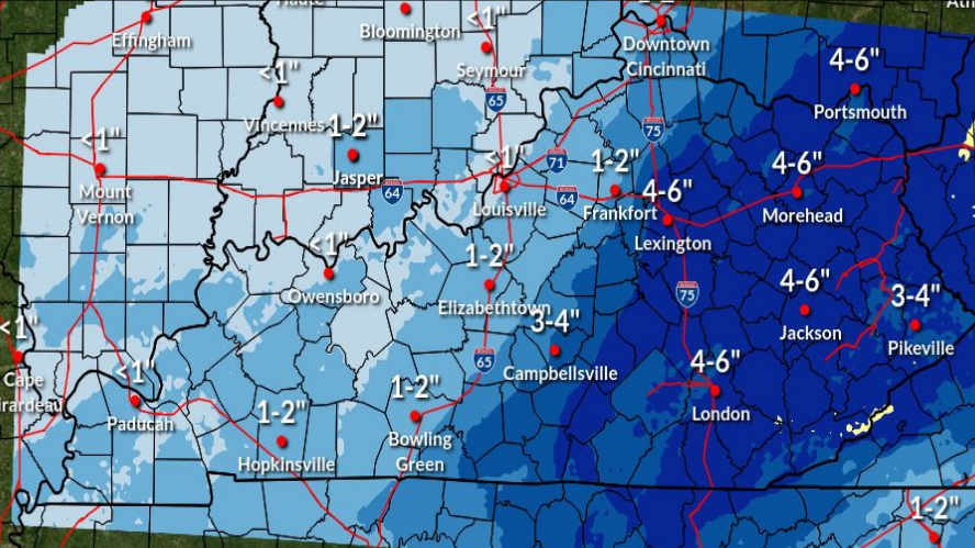
Crashing temperatures behind a strong cold front will bring a change from rain to snow over the region Friday night into Saturday. Snow accumulations between 2-4 inches, with locally higher amounts, are likely through Saturday morning, along with well below average temperatures and low wind chills through Saturday night. Winter Weather Advisories and Winter Storm Watches are in effect for the entire area.
WEATHER ALERTS
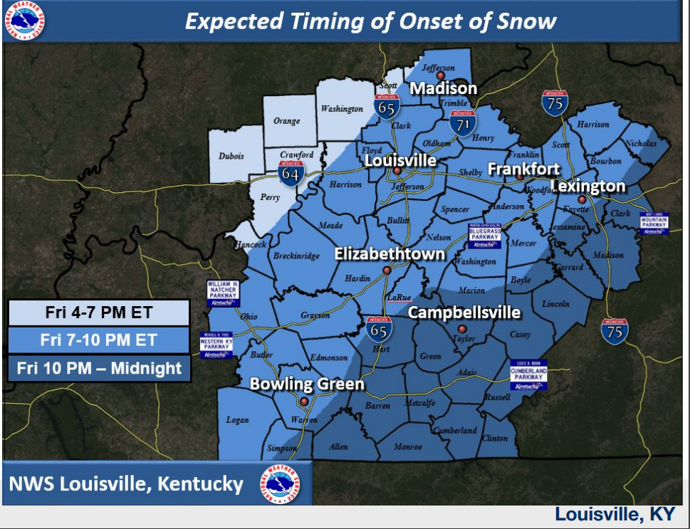
TIMING
NWS ACCUMULATION MAP
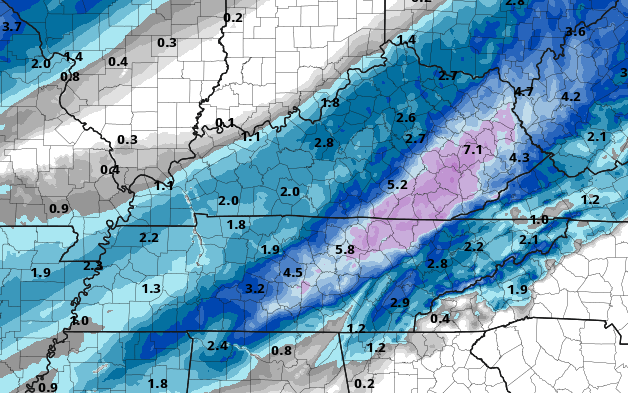
NAM Accumulation Map
.PNG)
CANADIAN Accumulation Map
.PNG)
HRRR Accumulation Map
.png)