


A-Plus Comfort Care presents the Big Dawg Weather Blog! For experienced care for your heat & air, give them a call at (270) 932-7421
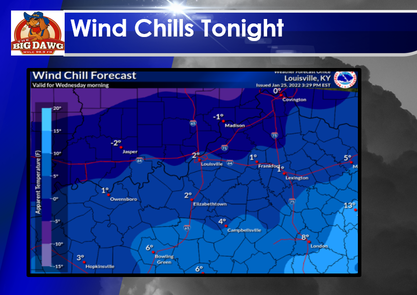
Good Tuesday evening, folks! Not a whole lot going on in the weather department over the next few days other than another reinforcing shot of cold air that will send wind chills into the lower single digits tonight.
Toward the end of the week, the potential for light snow appears to be increasing. How much snow we receive will depend on the low-pressure track and how strong the system is. Regardless, light snow showers appear likely during the day on Friday and into Friday night. Temperatures will drop into the teens yet again Friday night, so a light dusting up to 1 inch appear possible. Here are a few of the model runs below:
GFS MODEL:
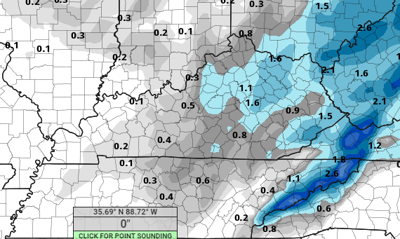
NAM MODEL:

In conclusion, light snow appears likely on Friday, but this won't be an event that will cause significant issues. As always, I will keep you updated on all the latest information. Stay tuned!
.png)