


A-Plus Comfort Care presents the Big Dawg Weather Blog! For experienced care for your heat & air, give them a call at (270) 932-7421
Good Sunday night, everyone! I am continuing to track a powerful storm system that will bring substantial amounts of wintry precipitation to someone in the Ohio Valley. Heavy rain, Freezing rain, sleet, and some snow are all possible before the week is over.
Here is the approximate timeframe that we are looking at:
Wednesday: Rain moves into the region, with temperatures rising into the 50's. Temperatures slowly drop throughout the state as we head into Wednesday night.
Thursday: Arctic Front will slowly progress across the state, with temperatures dropping roughly 20 degrees. The biggest question is how fast this front moves through the state. Heavy rain is likely south of the front, while Freezing rain and sleet are expected north of the front.
Thursday Night: Arctic air will push through the entire state, changing any rain to freezing rain/sleet with some snow.
Tonight's data, as expected, is still all over the place. I am confident that this storm isn't going to be a snowmaker for our area. The heavy snow is expected to stay well north, with our location in the battleground for heavy rain VS freezing rain/sleet.
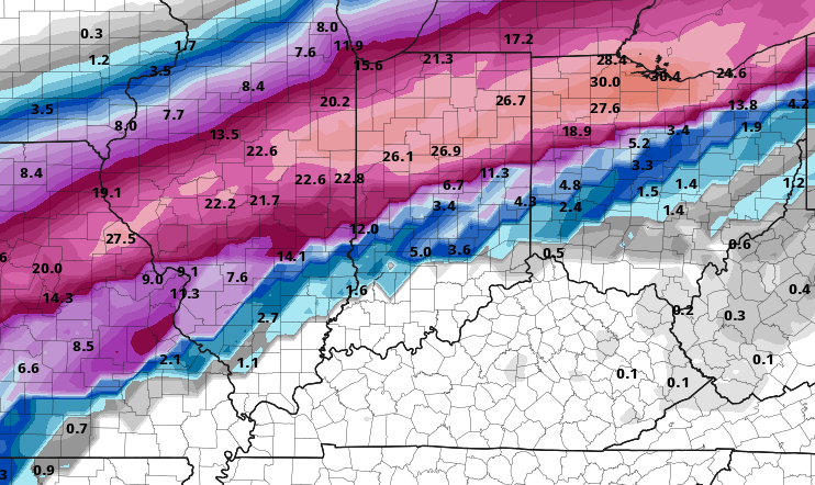
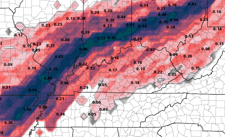
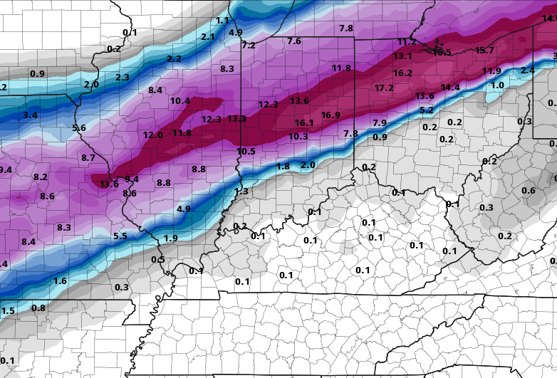
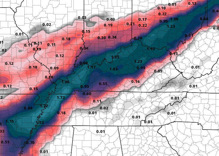
Here is the latest model data for tonight. The Canadian and GFS have updated, and the EURO will update in a few hours. The NAM model can only see out to 84 hours, so it can't see the entire storm yet, but It will be able to tomorrow.
GFS:
Potential Snowfall Output
Potential Ice Accumulation:
CANADIAN:
Potential Snow Accumulation:
Potential Ice Accumulation:
As you can see, our chances for significant snow are minimal, but our chances at a significant icing event are higher. Many questions still need to be answered, and I won't have those answers for a few more days. Models have a terrible time forecasting these arctic boundaries, and they do set up farther south due to the model's inability to handle dense arctic air.
As for now, pay attention to the latest forecast; everything is on the table, from a significant Ice Storm to just a plain heavy rain event. I'll be watching closely; stay tuned!
.png)