


The Big Dawg Weather Blog is presented by:

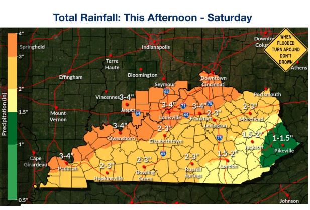
Good Tuesday Afternoon, Folks! Widespread moderate to heavy rainfall is likely Thursday evening through early Saturday morning. Total rainfall amounts of 2-4 inches are possible through Saturday, though thunderstorms could contribute to localized swaths of 4+ inches of rain. This rain will increase the risk of flash flooding and minor to moderate river flooding.
NWS Rainfall Forecast
In addition to the heavy rain threat, strong to severe storms are possible Friday afternoon, with the best chances across southern Kentucky. The SPC currently has areas to our south highlighted as the best opportunity for severe weather, but I suspect this will expand into our area in later forecasts.
SPC Friday Outlook
.PNG)
As always, Ill be watchig things closly, stay weather aware in the coming days!
.png)