


The Big Dawg Weather Blog is presented by:

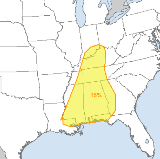
Good Saturday afternoon, Folks! I only have a short blog post with a few details, but I want to discuss the potential for severe weather in our area on Thursday. Looking at the data, we will see an area of low pressure bring moisture into the Ohio/Tennessee valleys by Wednesday night, resulting in some gusty winds and storm chances. Thursday is the day I have my eyes on; as a cold front approaches our area, a round of severe weather looks likely across the Mississippi, Ohio, and Tennessee Valleys. All the ingredients necessary for a significant severe weather outbreak will be present; however, there remain questions on the overall setup and track. Once these questions clear up, there will likely be upgrades to the current Storm Prediction Center Outlook that I have posted below.
SPC Thursday Outlook
I'll be watching things closely, but in the meantime, don't freak out or start worrying. We are still in "watch and see" mode. The best advice I can give is don't be scared, and be prepared!
Have a good Saturday, and I could have a LIVE tomorrow or Monday.
.png)