


The Big Dawg Weather Blog is presented by:

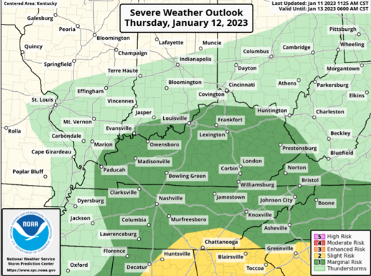
Good evening, Folks! Scattered showers and thunderstorms are expected early tomorrow morning and lasting into the early afternoon ahead of a cold front. A few of the storms may become severe during the morning hours. The main threat with severe storms will be isolated damaging wind, brief heavy rainfall, and possible hail. A tornado or two cannot be ruled out either. This isn't a significant severe weather threat, but we must watch any severe threat closely. The SPC has placed the entire area in the lowest severe weather risk.
SPC OUTLOOK
Temperatures will drop Thursday night, bringing scattered snow showers to the area on Friday. Minor snow accumulations under 1 inch are possible at this time, but Ill keep an eye on this.
Ill be monitoring things closly, stay tuned for updates!
.png)