


The Big Dawg Weather Blog is presented by:
.PNG)
Good Evening, Folks! I wanted to give everyone a quick update on what to expect over the next 48 hours! Multiple rounds of showers and storms will impact the region late tonight through early Wednesday morning.
Tonight
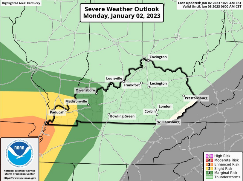
Isolated instances of severe weather will be possible during the overnight period. If severe weather does occur, damaging straight-line winds are most likely in the storms, with small hail and an isolated tornado possible. However, tonight's severe threat is extremely low. The SPC doesn't have our area at risk for severe storms tonight.
Tuesday
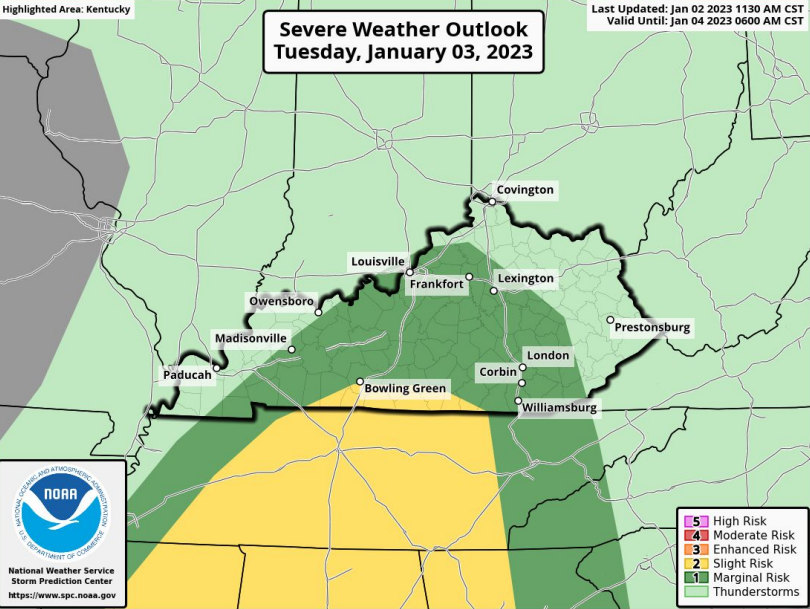
Storms will continue throughout the day on Tuesday, and below is the latest breakdown:
- One round of showers and a few storms Tuesday morning, then another round late Tuesday night.
- The best chance for storms Tuesday night is between midnight and dawn.
- Damaging straight-line winds, small hail, and an isolated tornado are possible.
- Outside of storms, gusty southerly winds of 30 to 40 mph will be possible Tuesday.
- Minor flooding may develop in spots that see the heaviest rainfall.
The SPC does highlight our area for the possibility of severe weather, but again, it is a low risk.
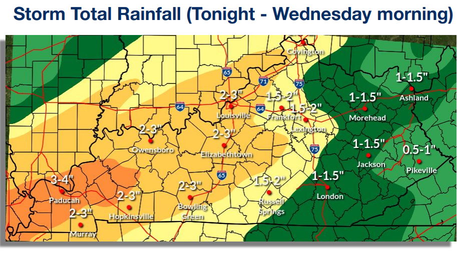
In addition to the severe storm threat, Widespread 1.5” to 3” expected with locally higher amounts. Localized minor flooding will be possible.
As with any severe weather threat, we must always be on our toes. I'll be monitoring things closely and will give updates as needed! Stay tuned
.png)