


The Big Dawg Weather Blog is presented by:
.PNG)
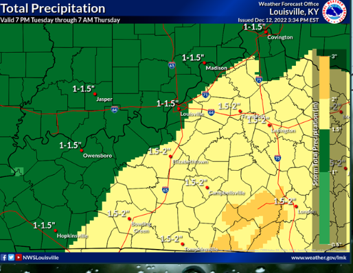
Good Afternoon, Folks! Thunderstorms with locally heavy rainfall will be possible Tuesday night through Wednesday night. A localized, minor flooding threat cannot be ruled out. 1-2 inches of rain is possible during this timeframe.
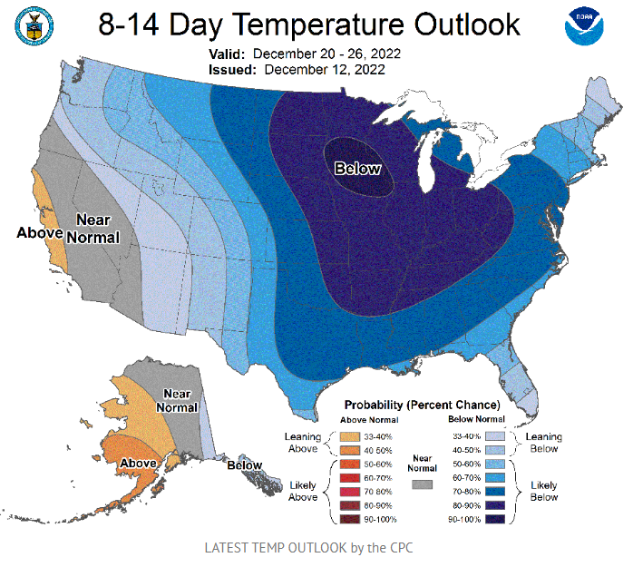
The big story that everyone is interested in is the pattern change that will take place during the second half of December. Almost all of the latest data suggests that cold arctic air will overtake much of the central/eastern U.S. Once you have cold air in place, you need a storm system to bring precipitation into the arctic air zone. We are still determining how far south this arctic air will track. If it's further north, our snow chances, locally, would be lower. If the cold arctic air is further south, our snow chances would be higher. Long story short, I only have a little information for you. But if you are hoping for snow on Christmas week, the first thing we need is Arctic air, and it appears we will have that. I will be watching things closely, and ill keep everyone updated as we progress closer and details become clearer!
.png)