


The Big Dawg Weather Blog is presented by:
- A-Plus Comfort Care
- Central Ky Construction & Concrete
- Razed Right Barbershop
- Insulation Solutions of Ky
.PNG)
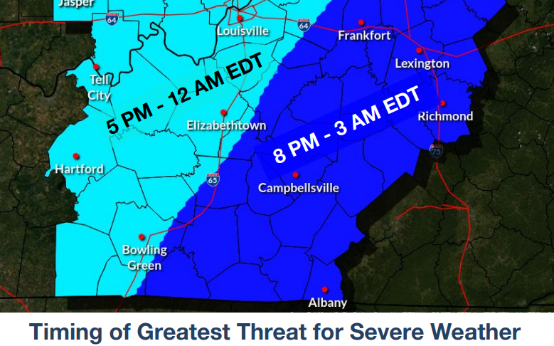
A threat of strong to severe thunderstorms increases over the area Wednesday evening into the overnight hours. At this time, the highest threat of severe weather stretches along and west of the I-65 corridor from through central Kentucky. Straight-line damaging winds and isolated tornadoes will be the main threats, with severe storms for Central and Eastern Kentucky. The biggest question is how fast these storms will move in, and how much energy will be available for them once they arrive. This will significantly affect how intense storms will be in our area. Please stay weather aware throughout the day tomorrow; we will be tracking it every second! Below are the latest slides/Info from the SPC/NWS:
Bottom Line
- Gusty winds of 30-40 mph Wednesday afternoon
- Strong to severe storms expected Wednesday evening into the overnight hours
- Damaging winds and isolated tornadoes are the main threats, although large hail and localized flash flooding are possible
SPC Outlook
.PNG)
TIMING
.png)