

The Big Dawg Weather Blog is presented by:
- A-Plus Comfort Care
- Central Ky Construction & Concrete
- Razed Right Barbershop
- Insulation Solutions of Ky
.PNG)
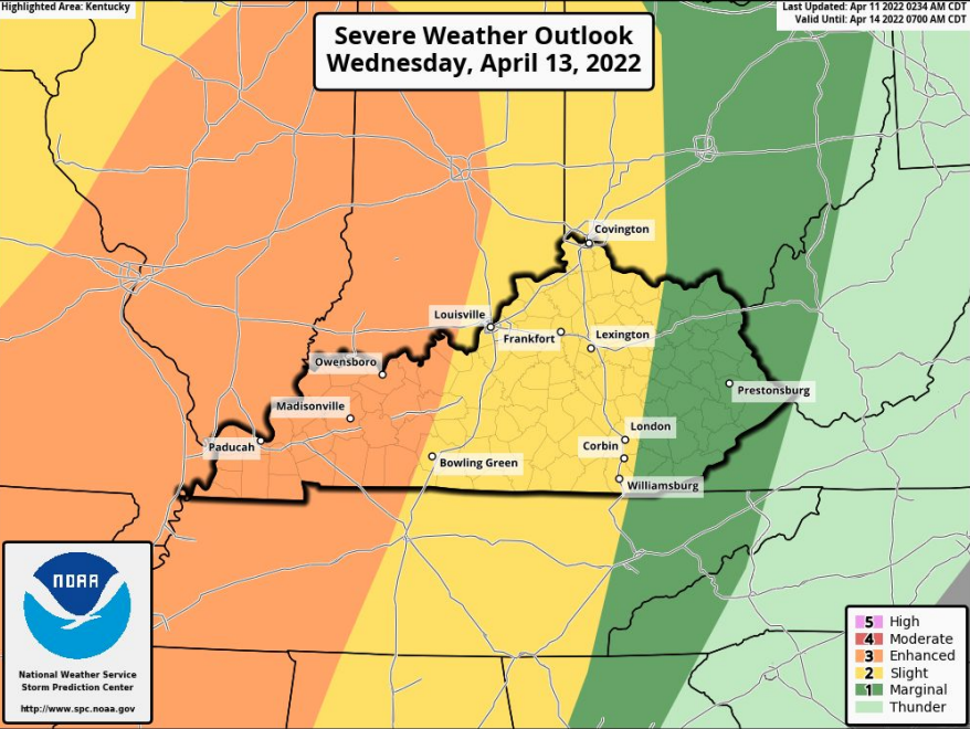
Isolated thunderstorms will be possible on Tuesday afternoon and could become strong to severe. However, a more significant threat of strong to severe thunderstorms will be seen across the outlook area on Wednesday afternoon into the overnight hours. Our biggest question mark will be the availability of instability (energy) when the line arrives. At this time, the highest risk of severe weather is in Western Ky, and west of I-65 in central Kentucky, as instability will be highest there. The main threat with
strong/severe storms will be straight-line winds, with the potential for an isolated embedded spin-up tornado within the line.
Bottom Line:
- A line of strong to severe thunderstorms is expected to develop in advance of the cold front.
- Damaging winds, large hail, and isolated tornadoes will be possible will be possible with these storms.
- Isolated severe storms possible Wednesday afternoon, but more widespread severe potential between 8pm EDT and 4 am EDT
- Stay tuned, as there is still some uncertainy with this system
SPC OUTLOOK:

.png)