

.webp)
The Big Dawg Weather Blog is presented by:
.PNG)
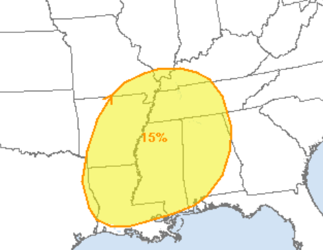
Good Saturday night, everyone! Temperatures today are much colder than what we experienced on Friday. Some light snow showers or flurries are possible tonight and tomorrow, but I don't see any real threat for snow any time in the foreseeable future. We may have seen our last real, measurable snowfall of the season. However, it is still officially winter, and we have seen snow systems in the month of March numerous times, so we'll have to wait and see. Im watching a strong system will move across the region next Thursday, bringing the possibility of a few thunderstorms Thursday afternoon. On Thursday, the Storm Prediction Center has placed Kentucky's southwestern portions at risk for severe thunderstorms. Heavy rainfall could also become a threat, as some of the model data suggest 1-3 inches of rain over 12-18 hours. Stay tuned as the forecast changes over the coming days. Have a great weekend, folks!
Storm Prediction Center Outlook on Thursday
Heavy Rainfall Potential on Thursday

.png)