

The Big Dawg Weather Blog is presented by:
.PNG)
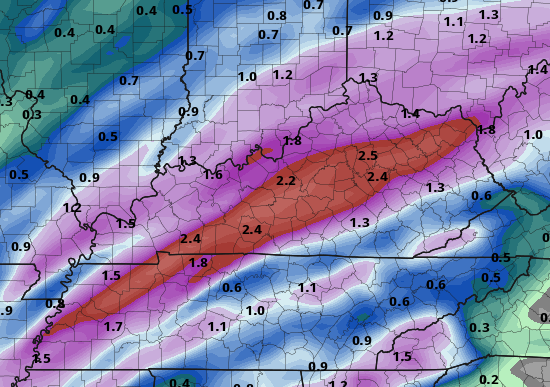
Good Sunday night, everyone! We will look at two waves of rainfall this week, with the first coming tomorrow night into Tuesday. Showers and a few thunderstorms will bring heavy rainfall again on
Wednesday night, especially across south central Kentucky. Rainfall amounts up to 2 inches could result in localized flooding of low-lying areas, and subsequent river flooding.
The latest GFS model is showing 2-3 inches of rain possible before the week is over.
GFS Forecast Rainfall through Thursday Night
As aways, Ill be monitoring this weeks weather, and Ill provide updates as needed! Have a great week!

.png)