
The Big Dawg Weather Blog is presented by:
.PNG)
Good Afternoon, Folks! It's officially time to fire the blog back up as we head into winter! The blog will be updated at least once a week, with more posts if the weather is active!
Multiple rounds of rainfall are expected through early Friday. The heaviest rains are likely Thursday into Thursday night and could result in localized flooding.
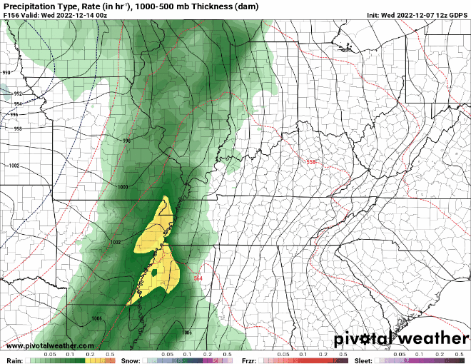
I am monitoring a more significant storm system that will impact our area next week, which has the potential to produce strong storms while transitioning to isolated snow showers. The latest Canadian model shows that exact scenario: a line of solid storms followed by some light snow. It's hard to say how intense these storms will be or if any snow showers will accumulate. Both look unimpressive, but it's something to watch as we progress toward next week. I'll keep everyone updated, have a good evening!

.png)